

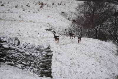
Brits in large parts of the country could see snow flurries later this month for an entire weekend as temperatures tumble to freezing.
A high pressure system is currently in charge with the country enjoying mild conditions after the storms and this is expected to remain the case for the coming couple of weeks before it starts to look a lot more wintry by the end of the month.
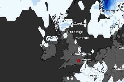
Maps from WXCharts show temperatures drop on the weekend of October 25-26 and with it there is a chance of snow blanketing the country. On the morning of Saturday, October 25, there is a possibility of snow which runs across northern England, Wales and Scotland.
READ MORE: UK forecast shows Brits could see autumn snow as '169 miles' at risk of flurries
READ MORE: Brits warned they face £1,000 fine if they fail to do one thing before storm
By the evening those clouds will have moved south in England but there still remains a chance of snow in Wales and Scotland. Then on Sunday there is a slim possibility of snow for eastern England and more probability for Scotland.
And over that weekend it is likely to hit freezing in the west of Scotland and be in the low single figures in north west England. But across the UK it is likely to be bitterly cold except for possibly the south coast where it could reach 11C.
The Met Office states that for the period from October 25 to November 8 the weather is set be more unsettled. It predicts: "This period is likely to see changeable conditions across the UK with low pressure systems tending to dominate. Showers or longer spells of rain are likely at times, perhaps heavy in places.
"There will however likely be some temporary drier interludes at times. Temperatures will probably be close to normal." Up until that point it is the current high pressure that is expected to remain in control which means it is generally set to be dry.
The Met Office says for October 15-24: "High pressure is expected to be the dominant weather type across the UK at the start of this period. Whilst some rain and drizzle is likely in parts of the southeast and north, mainly over the higher ground, much of the UK will be predominantly dry.
Cloud amounts will vary, starting predominantly cloudy, but most areas will see some spells of sunshine and there could be a few isolated fog patches overnight. Temperatures are likely to be close to normal for the time of year.
"During the second half of this period, there are signs that the overall pattern will shift with low pressure systems probably moving in from the west in some fashion. However, details of any wetter and more unsettled weather are still very uncertain."
You may also like

2nd Test: Jadeja eyes early breakthroughs on day three despite not much spin available
India a living example of democracy, equality: LS Speaker Om Birla
Heartbroken man ends life as wife elopes with paramour on Karva Chauth
England star sent home from camp as Thomas Tuchel decides on replacement
ProBreeze dehumidifier that 'removes excess moisture from air' has hidden discount


